As scary as it sounds, hiking up to the viral Instagram spot – Suicide Cliff, could be one of the most challenging things to accomplish in Hong Kong. But the panoramic view of the Kowloon peninsula up the hill deserves every single drop of your sweat and the dirt on your hands. Here is a complete guide to help you get to the “infamous” place.
Fei Ngo Shan, a 600-meter tall mountain, offers two hiking trails that suit different preferences: one is moderate but longer whilst the other one is shorter yet daring. The starting points of both trails are at Fei Ngo Shan Road - you could take bus No. 91/91m/92 from Diamond Hill MTR Station Exit C2, get off at Good Hope School, head east and walk along Clear Water Bay Road until its intersection with Fei Ngo Shan Road.
The Gentle Path to Suicide Cliff
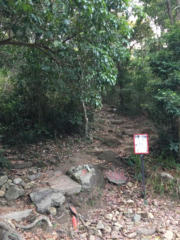
Less experienced hikers should opt for the 9.5km moderate path from the start of Fei Ngo Shan Road, which takes around 3.5 hours. Walk up the slope, take the stone stairs after passing a wooden sign marked with “Ma On Shan Country Park” to the Kowloon Peak and walk down the uneven and steep surfaces to the photo hotspot. Please look for a rock labeled with "328" and a "Danger" sign there to start your journey.
The Strenuous Path to Suicide Cliff
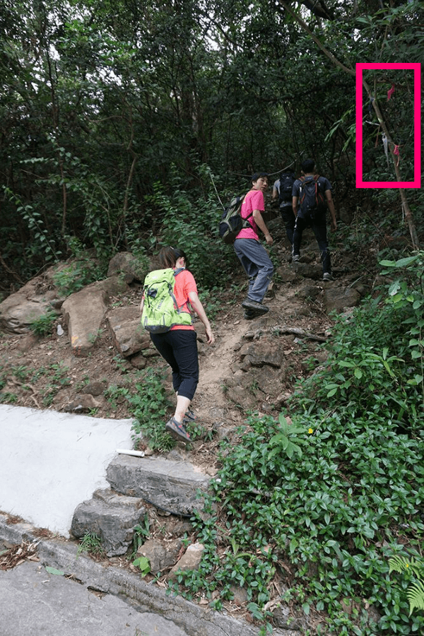
If you wish to experience the steepness of the mountain, take the 6.5km strenuous south route starting from 1 Fei Ngo Shan Road and clamber up with your hands and legs. Just a heads up that this is not an official trail so the route can be quite ambiguous – but you should be able to figure it out if you see the ribbons dangling from the trees and the ropes lying on the slopes. The initial section is still manageable climbing over boulders with the help of the ropes but the real danger is the steep and rugged paths with loose stones towards the peak, which you often have to hold onto the bushes around to stay balanced. Spend about 1.25 hours and keep climbing up until you see flatter surfaces, where the suicide cliff comes into view.
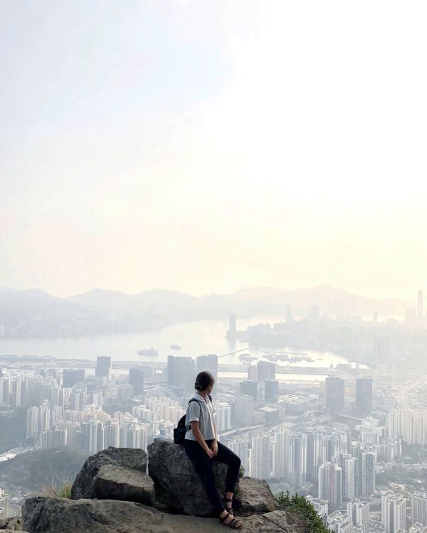
Overlooking the entire Kowloon Bay and the Victoria Harbor, the large stone platform once featured by National Geographic is every photographer’s dream. Put your hands up in the air and strike a pose – the breathtaking view does deserve thousands of pictures. But watch your steps as there have been serious injuries and deaths from the cliff, which even happens to professional hikers, so don’t do anything irrational.
.jpg)
Directions to get back down:
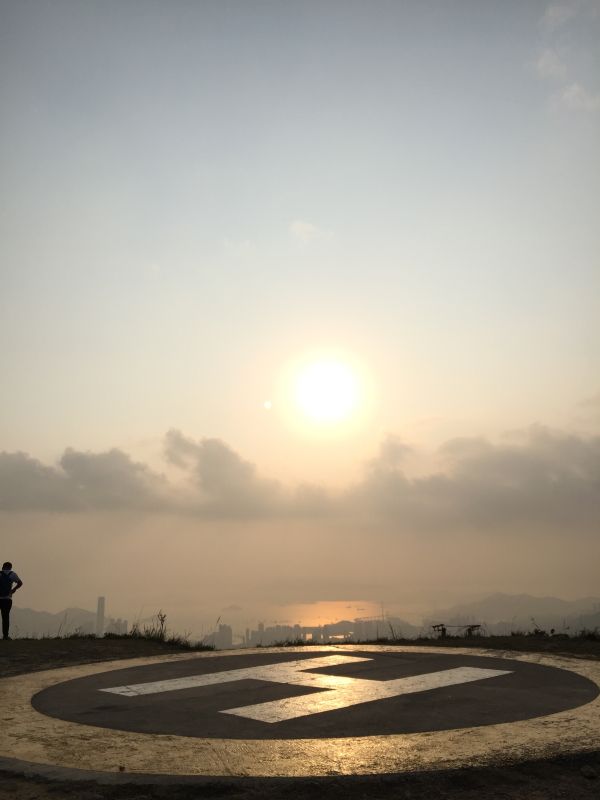
Once you reach the peak, walk past the helipad next to the Kowloon Peak Television and Radio Transmission Stations, where you will see a pathway of stone stairs leading you back down Fei Ngo Shan Road. Take bus No. 92 at the top of Good Hope School to Choi Hung MTR Station.
What else to visit?
Another Instagram sensation is the Choi Hung Estate where you can get to easily from where you get off! The cluster of rainbow-colored buildings is one of the oldest public estates in Hong Kong and the reason why the exterior is painted with 8 colors stems from the idea of bringing more energy to the neighborhood and the literal meaning of “Choi Hung”, which is rainbow in Chinese. Do stop by and get yourself photographed with the most striking backdrop!
Recommendations
1) Do bring sunscreen, hat, towel, gloves, hiking pole, enough water, and snacks to protect yourself from the sections without shades and the climb.
2) Safety always comes first so make sure you do adequate preparations and precautions for the hike, and grab a few friends as well to climb with you to ensure help is there whenever needed. People with fewer experiences of hiking or acrophobia are not encouraged to hit the trails.
3) Avoid climbing up during hot seasons as it can be really sticky hot, and not to mention there are no shades at all around the cliff and the peak.

Peggy here, and I am a storyteller. Despite not being a professional tour guide myself, I am thrilled to share and write about the fun things to do in town, the untold stories & even my personal observations.


20 minutes from Diamond Hill MTR Station Exit C2
ALL HOURS
The hike from the starting point will take approximately 3 hours to complete. We suggest starting between 09:00 and 17:00, or if you want to capture some sunset pictures, starting 2 hours before sunset.
Sun
ALL HOURS
Mon
ALL HOURS
Tue
ALL HOURS
Wed
ALL HOURS
Thu
ALL HOURS
Fri
ALL HOURS
Sat
ALL HOURS
Not Wheelchair Accessible
Wear appropriate hiking shoes and clothing, bring enough water, and we highly recommend not going alone.